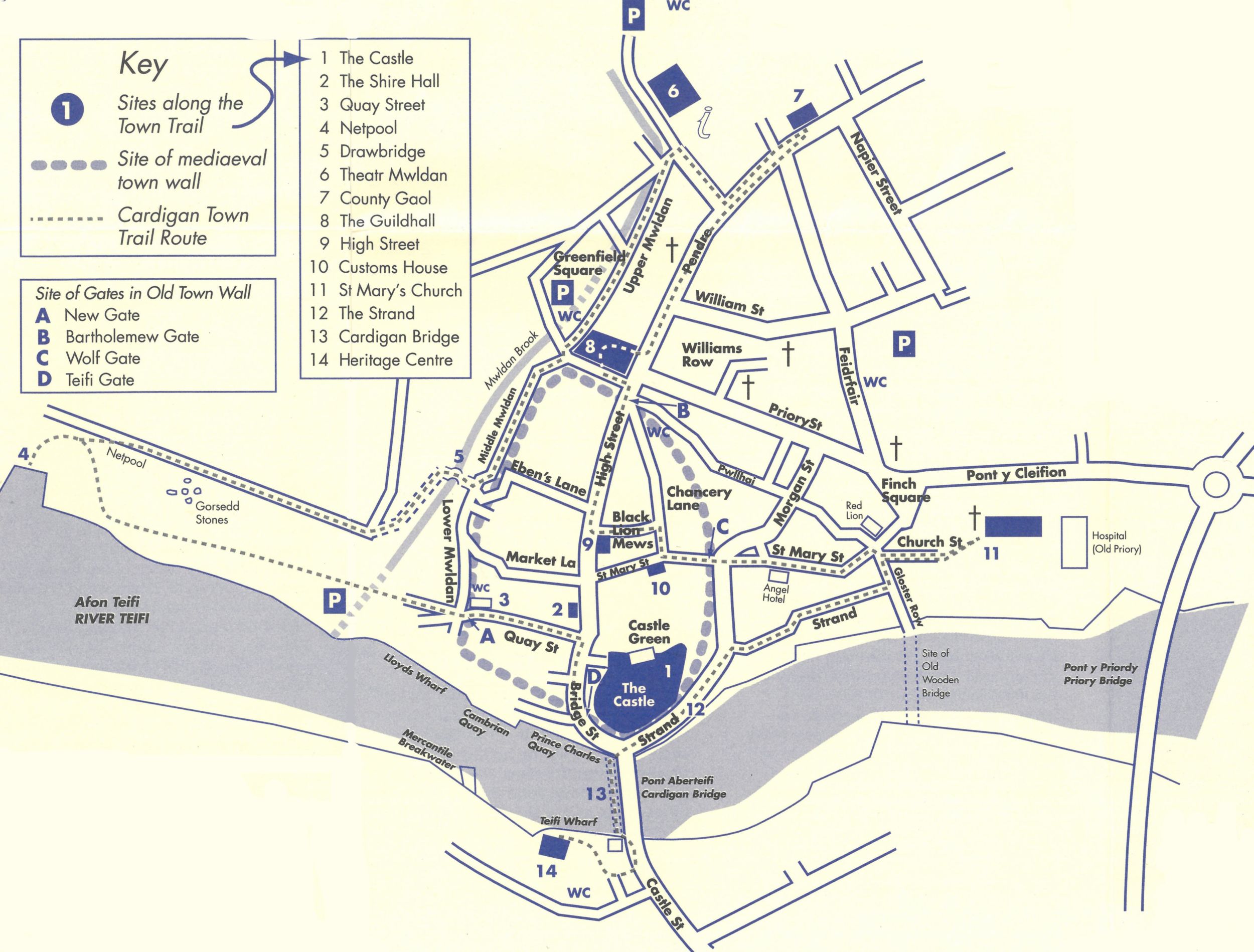
Cardigan Trail
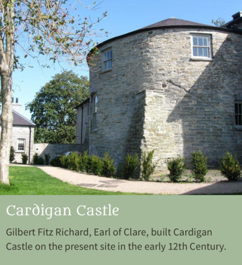 |
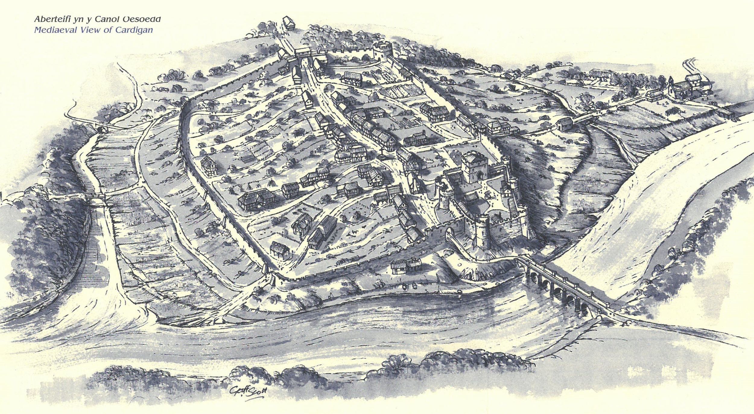
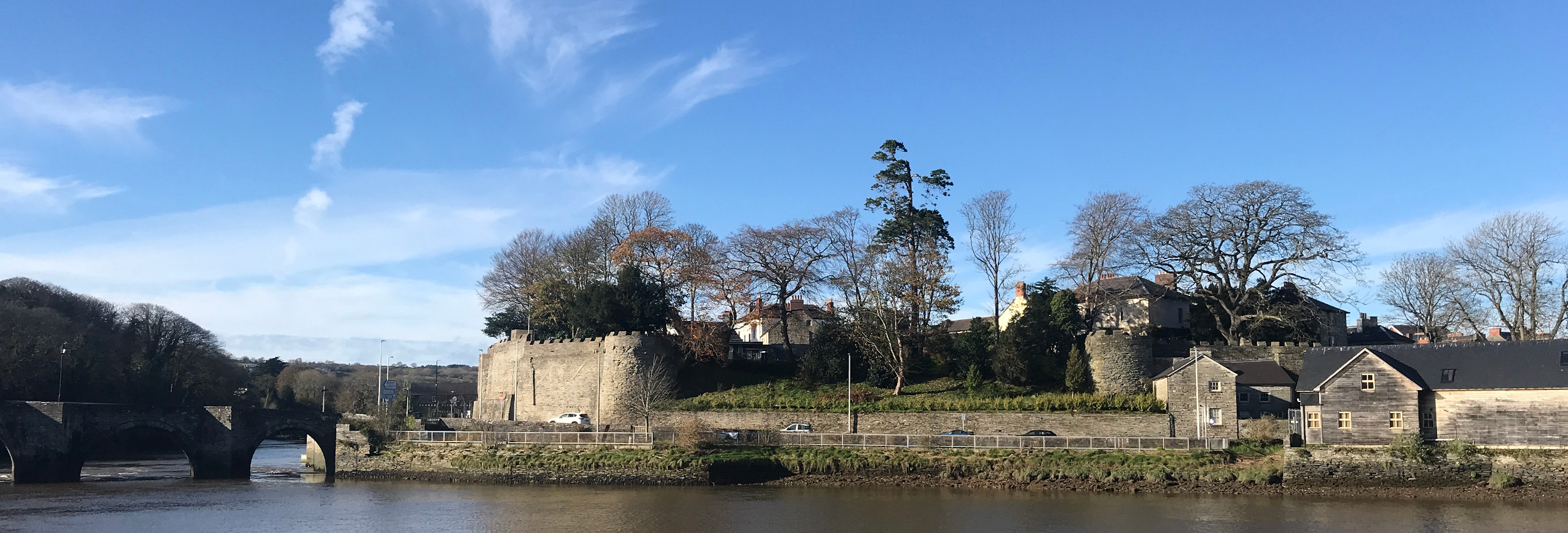
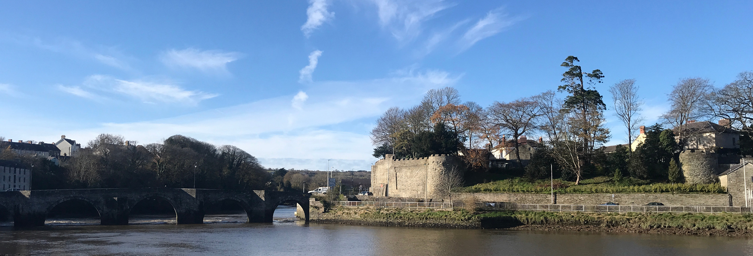
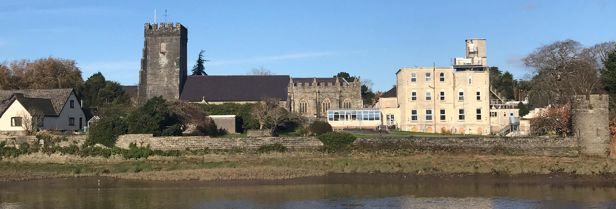
1 The first castle in Cardigan was built by the Normans in 1093. Gilbert Fitz Richard, Earl of Clare, re-built it on the present site in the early 12th Century and the town gradually grew up around its walls. Following years of conflict, Lord Rhys ap Gruffydd, the famous Welsh prince, captured the castle in 1165. He rebuilt it in stone and, to celebrate its completion in 1176, the first ever competitive Eisteddfod was held in the castle. The contest was for music and poetry with a prize of a chair. Notice the commemorative plaque on the standing stone under the castle wall, the castle was re-built many times over the years and was eventually destroyed by Cromwell’s troops during the Civil War, in 1644, using cannon fire. The imposing buildings opposite the castle were erected by wealthy shipping merchants of the 18th and 19th Centuries. Recently the castle has undergone major refurbishment and has become a leading welsh visitor attraction.
|
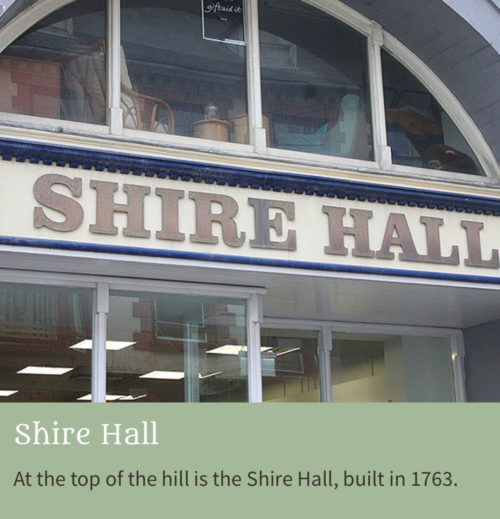 |
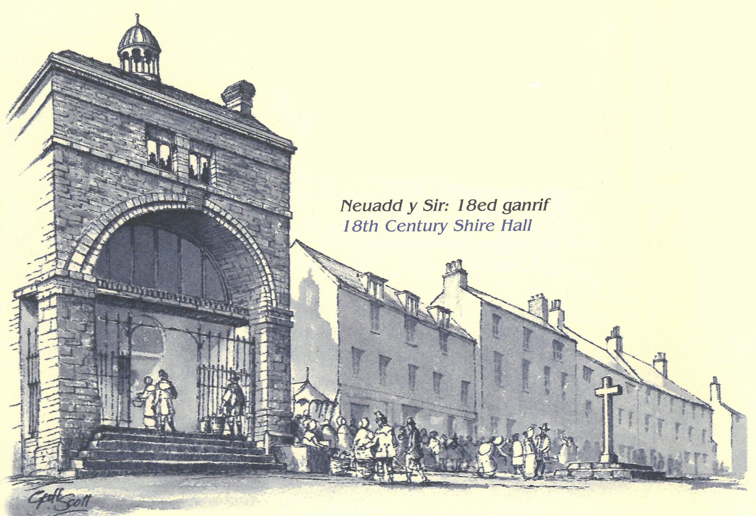
2 At the top of the hill is the Shire Hall. Built in 1763, it took over the functions of courthouse and council chamber from the castle. After being convicted, prisoners had to walk in chains through the main street to the County Gaol, being pelted with rotten vegetables by the crowd. The building also served as a corn market. The mediaeval market cross stood just beyond the Shire Hall in the middle of the road. The Shire Hall’s functions were passed to the new Guild Hall a century later and the building passed into private ownership.
|
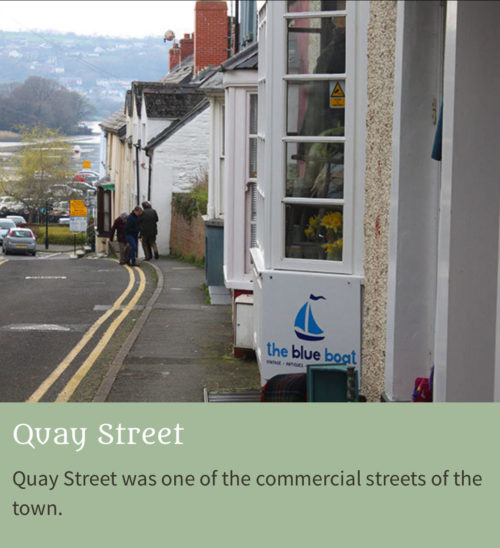 |
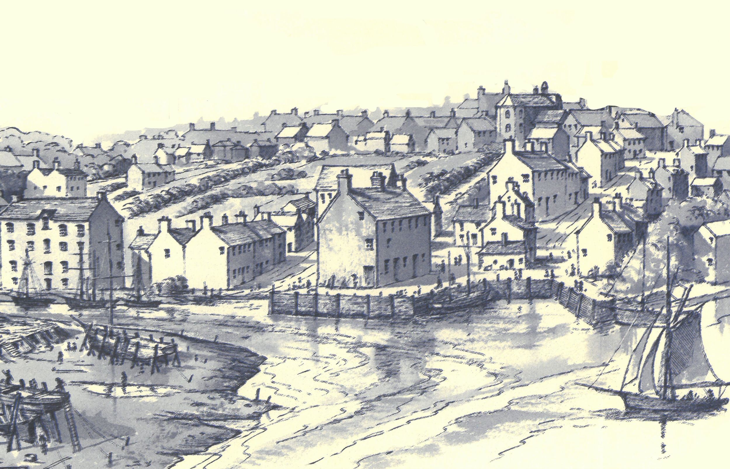
3 Walk down Quay Street which was one of the commercial streets of the town. There were numerous coal merchants in the street trading in coal which was landed at Lloyd’s Wharf at the bottom of the street. Imagine the scene before you as you stand at the end of the road with the bustle of ships loading and unloading their cargoes at the quayside. Pass through the site of New Gate to the car park, the original location of Cardigan’s shipyards. Follow the footpath up the bank to the viewing point. |
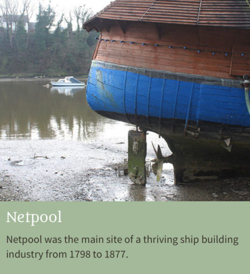 |
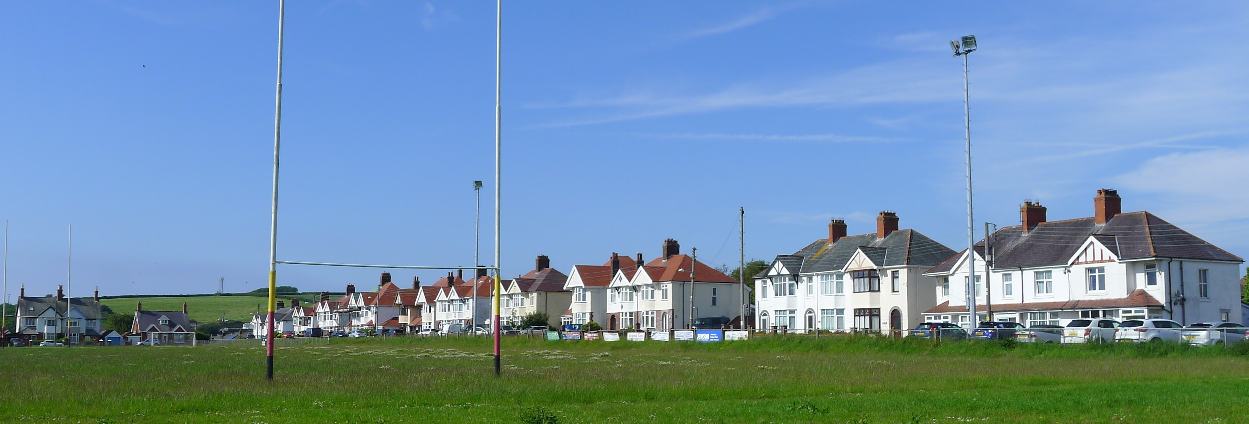
4 Originally named as the place where fishermen’s nets were mended, Netpool was the main site of a thriving ship building industry from 1798 to 1877. More than 1,000 people were employed in ship building and associated trades. On the top was the old saw pit where oak trunks were sawn by hand into planks. Nearly 200 sailing ships were built here in the Netpool area. Many specialised allied trades grew to support the important shipbuilding industry. The demise of Cardigan as a port was caused by the silting up of the river, the change from sail to steamships and the arrival of the railway in 1885. A little further along the trail are the Gorsedd Stones which mark the 1976 National Eisteddfod of Wales, held in Cardigan to celebrate the 800th anniversary of the very first Eisteddfod held at Cardigan Castle.
|
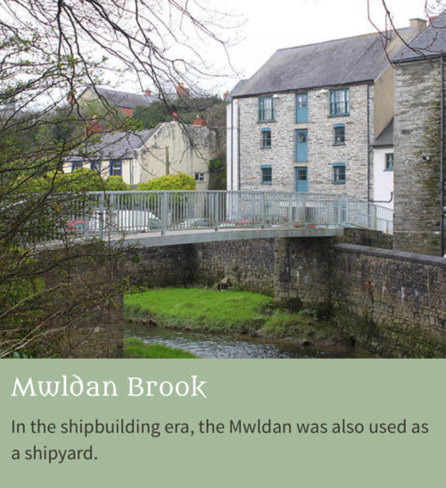 |
5Cross the Mwldan brook on the site of the old Drawbridge – now long gone. In the shipbuilding era, the Mwldan was also used as a shipyard and ships passed up the stream on the full tide. An old warehouse faces you and just to the left, high above, you can see the line of the old defensive town wall built by Robert Waleron in 1244. Some fragments of the mediaeval masonry can still be seen. The old commercial centre was contained within the walls with the manual industries located outside. |
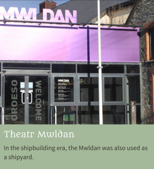 |
6 Continue along the trail past the Market Hall through the car park to Theatr Mwldan. This building was fairly recently converted from an old slaughterhouse built in 1858. Previously, it had been the site of the town’s poor houses. On the hill behind was the site of the 19th century brickworks. Close by was the town mill and a bath house. |
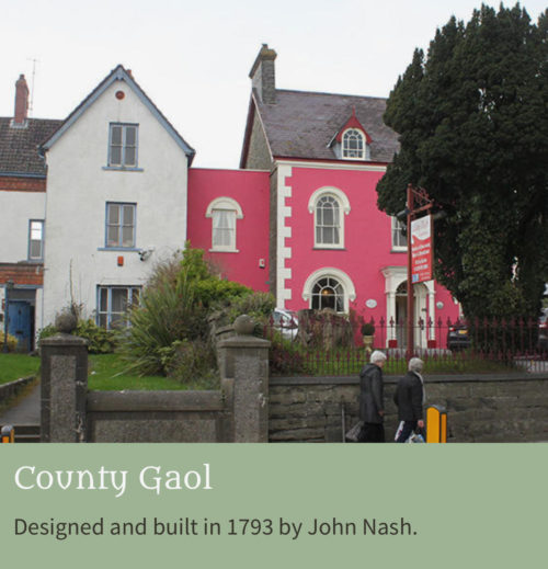 |
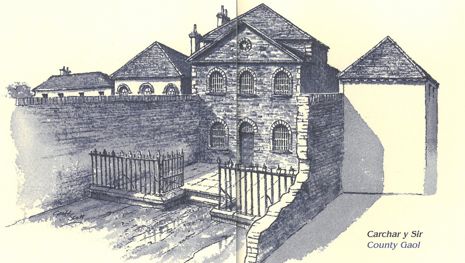
7 Turn left at the top of the hill to find three large town houses set back from the road on your left. This was the site of the former County Gaol. With its high side walls and imposing Georgian architecture, it was designed and built in 1793 by John Nash and stood on the edge of the town. It was converted in 1881 to a police station and a private house. The northern toll gate stood a few yards north of the gaol.
|
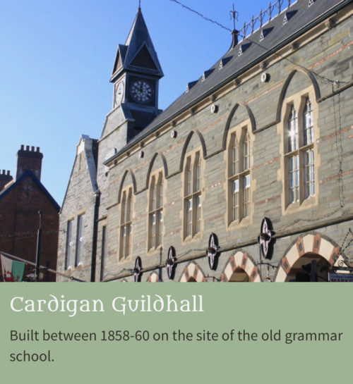 |
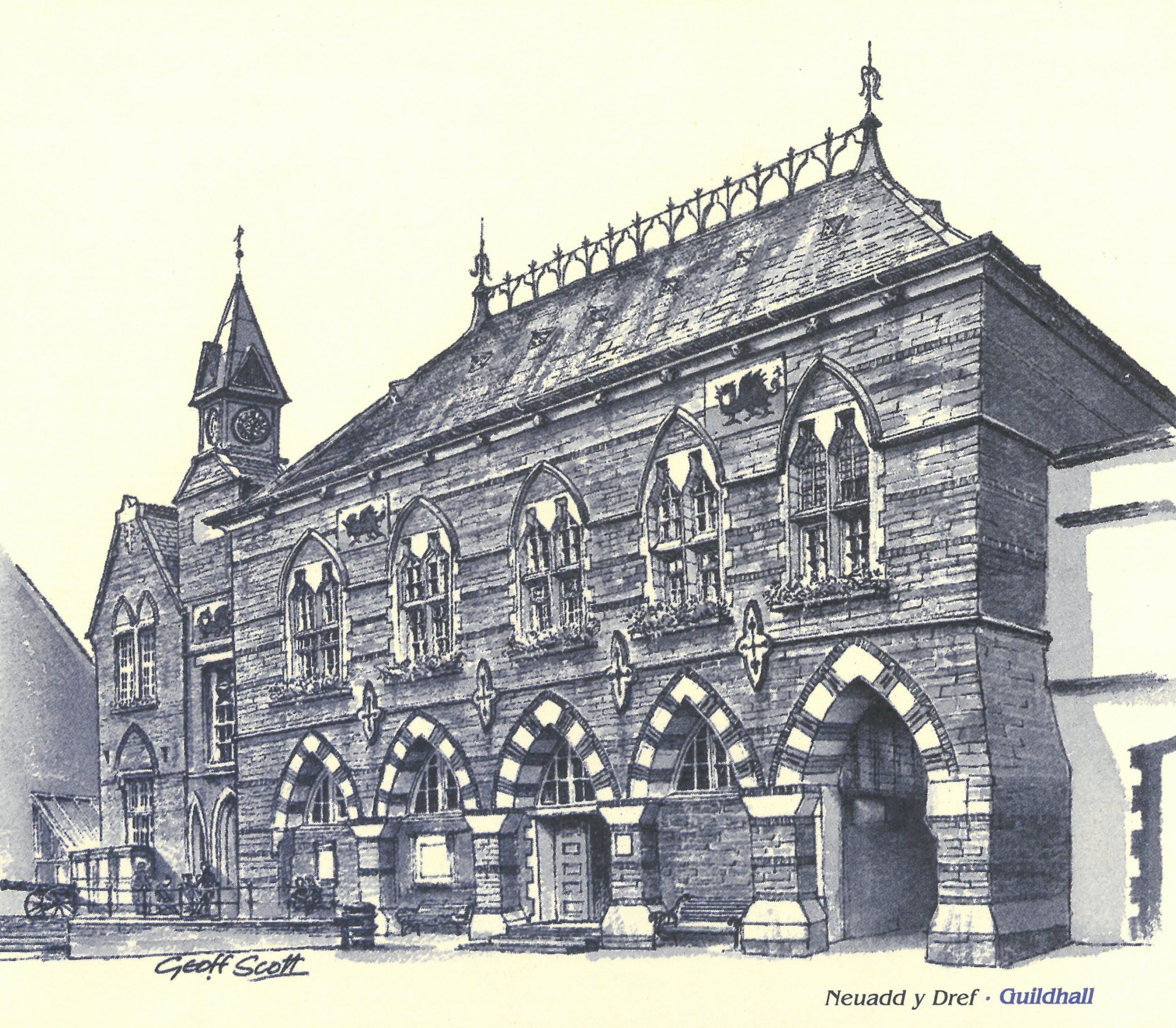
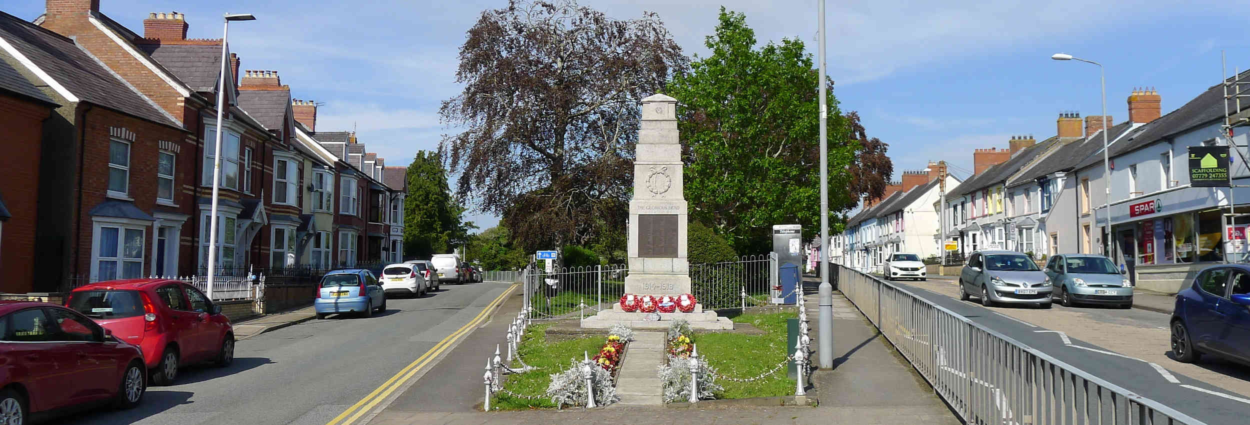
8 Follow the main street back into town passing the 1832 Tabernacle Methodist Chapel to the Guildhall which, with its indoor market, was built between 1858-60 on the site of the old grammar school. It was the first municipal building designed in the Ruskinian Gothic style. The clock tower was added in 1892 by David Davies of Stanley House. The Russian Field Gun commemorates the infamous Charge of the Light Brigade, which was led by Lord Cardigan. The market hall, with its vaulted ceilings and gothic arches, is well worth a look inside.
|
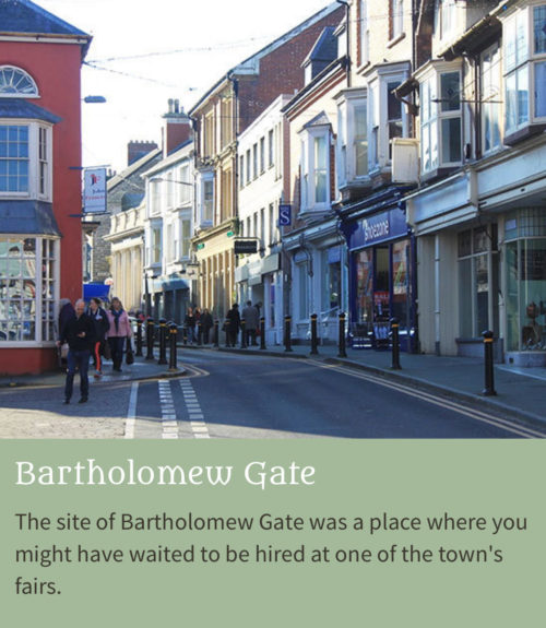 |
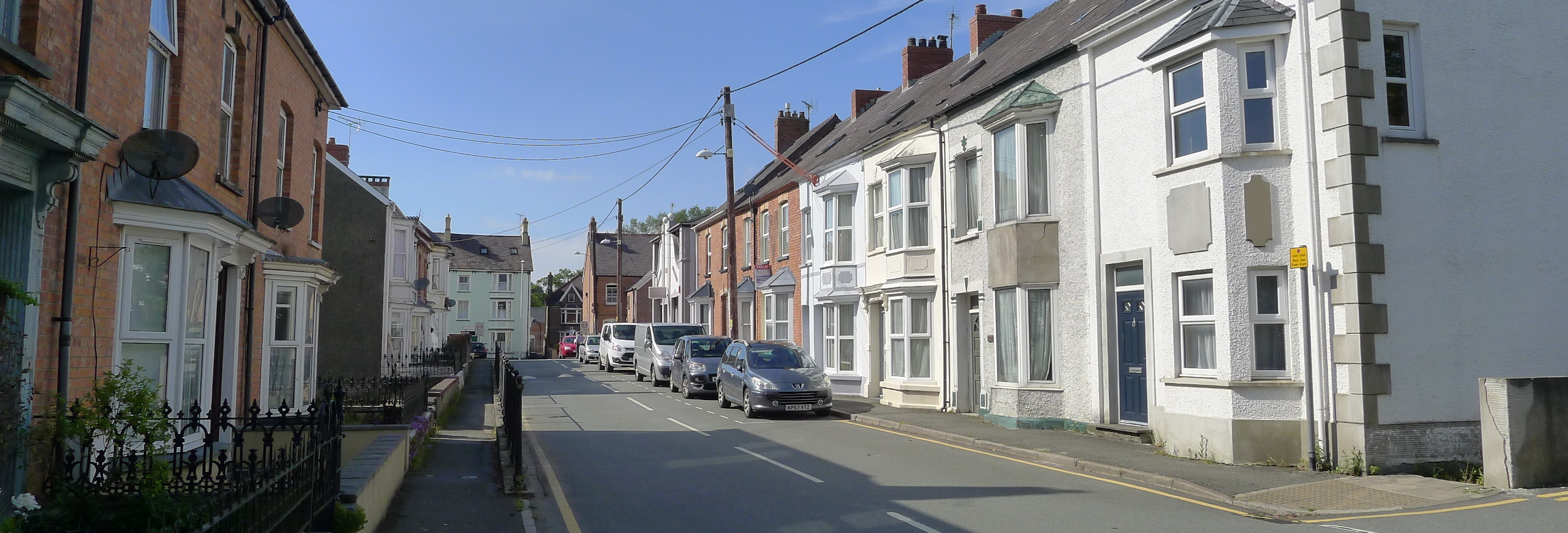
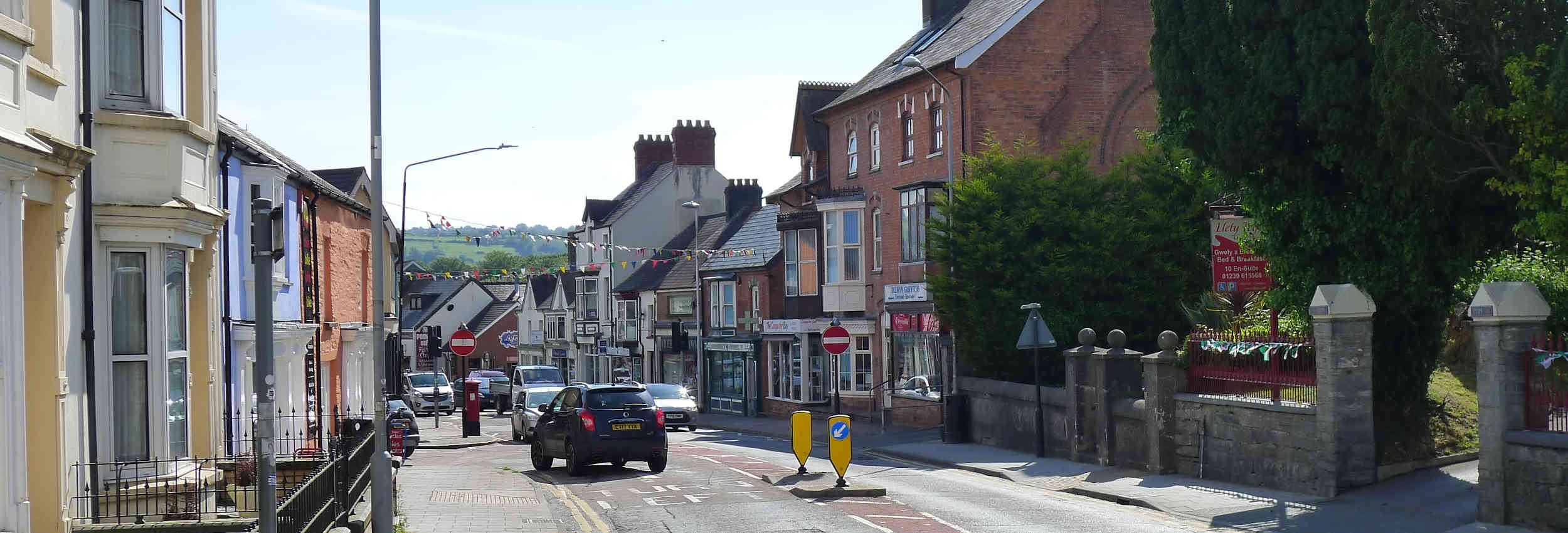
9 Continue along High Street through the site of Bartholomew Gate (by The Original Factory Shop), a place where you might have waited to be hired at one of the town’s fairs. To this day, on the last Saturday in April, people still parade their stallions through the main streets of the town. Turn left through the arch at the Black Lion Hotel, which was an old coaching inn. You can imagine the smell of horses and leather as you walk through the mews. Like all seaports, Cardigan had many inns and public houses – no less than 50 in 1850. Turn right into Chancery Lane |
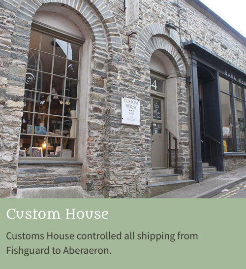 |
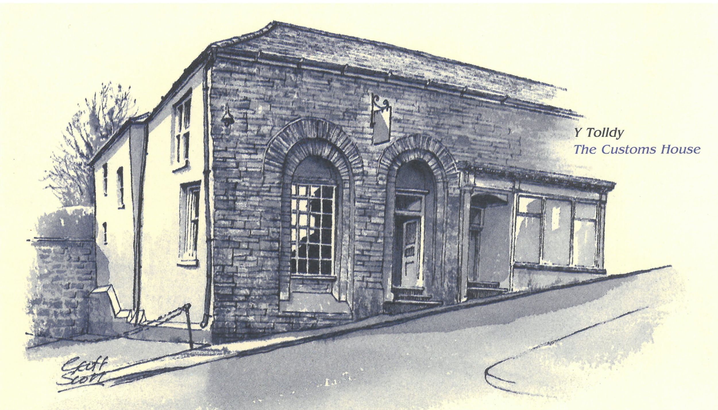
10 In 1815, Cardigan was the most important of all Welsh ports and its Customs House, at the end of Chancery Lane, controlled all shipping from Fishguard to Aberaeron.
On your left, the impressive late 18th century Georgian building was a gentry town house. Walk downhill to pass through the site of the old Wolf Gate on your way to the Angel Hotel, also an old coaching inn, which was once a hospice of the Knights of St. John and a resting place for pilgrims. Continue along St Mary Street and into Church Street.
|
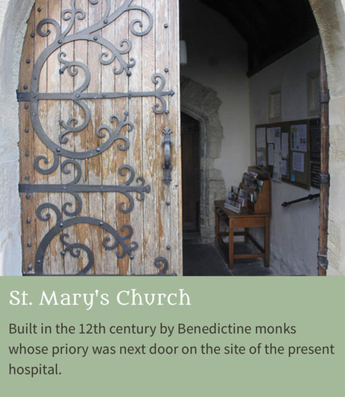 |
11 At the end of Church Street is St. Mary’s Church, built in the 12th century by Benedictine monks whose priory was next door on the site of the present hospital. Its fine chancel, rebuilt in the 15th century, may have housed the original statue of Our Lady of Cardigan, which drew many pilgrims to the town but was destroyed in the Reformation. The church and tower were rebuilt in the 18th century. Many of the gravestones relate to Cardigan’s maritime past. Backtrack past the Angel Hotel and turn left. |
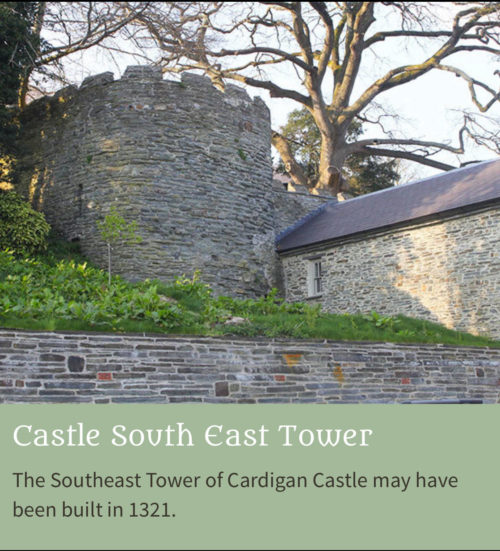 |
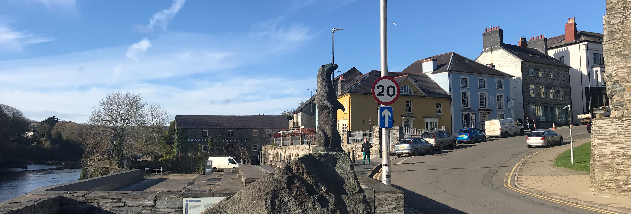
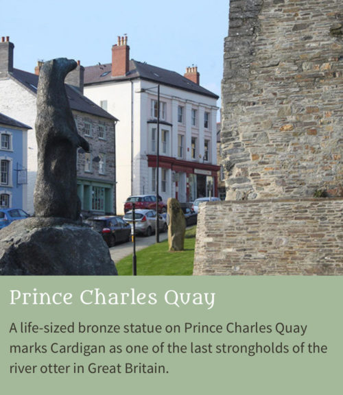
12 Proceed west along the Strand. There have been foundries and workshops in the buildings on the left, for about 150 years. Continue to Cardigan Bridge passing the mediaeval South East Tower of Cardigan Castle. Notice the bronze statue of the Teifi Otter on Prince Charles Quay. |
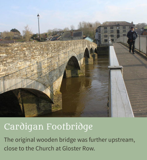 |
13 Cross the footbridge adjacent to Cardigan Bridge. The original wooden bridge was further upstream, close to the Church at Gloster Row. It is said to have once famously collapsed under the weight of soldiers fleeing from the battle of Crug Mawr (1136) when the victorious Welsh drove the Normans back across the river. The present bridge was partly re-built in 1726 and originally had seven arches, but it is likely that a bridge has occupied this site since the 13th century.
|
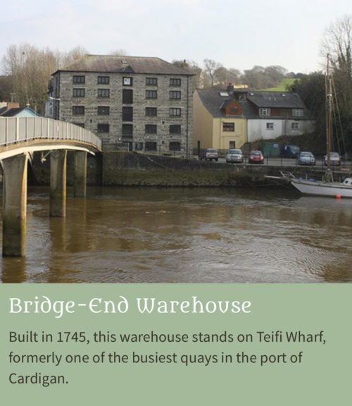 |
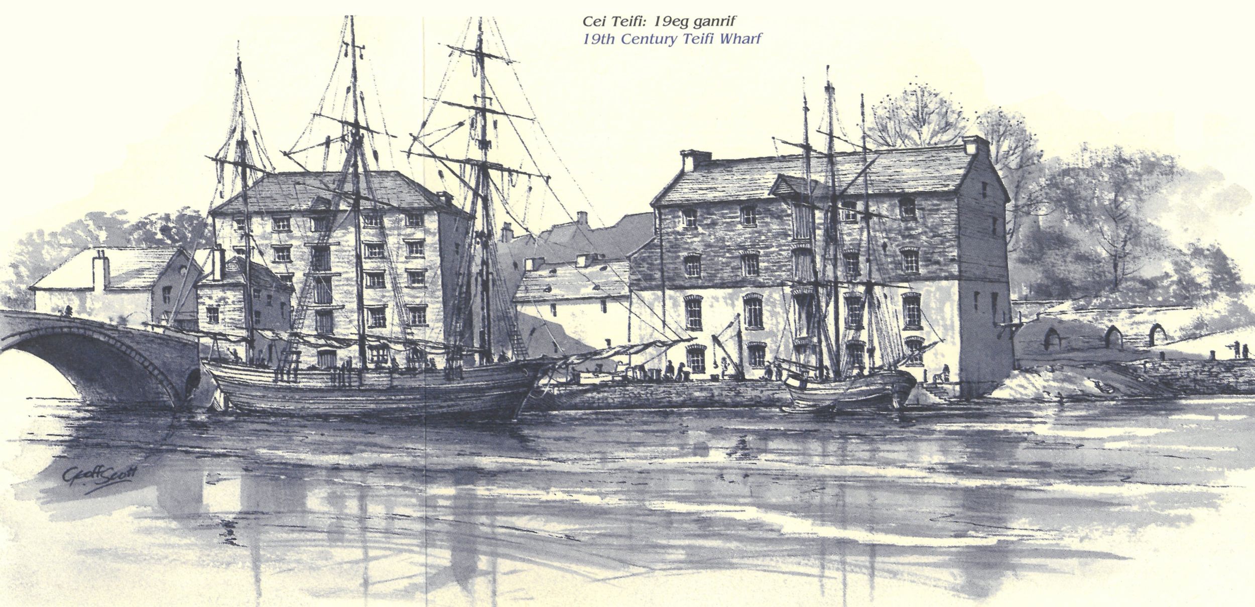
14 Built in 1745, these warehouses stand on Teifi Wharf, formerly one of the busiest quays in the port of Cardigan. The buildings housed a sail loft and a granary and general storage of imported goods. This quay was used extensively for the import and export of timber and other goods. Behind the building were several lime kilns and a rope yard stretching up the hill along the main road.
|
 |
15 By the early 1800s Cardigan was recognised as one of Britain’s largest ports. At the height of its commercial activity the port was only surpassed by London, Liverpool and Bristol. Cardigan became one ofthe country’s largest ports for transatlantic emigration, sending ships like the Active and Albion to New Brunswick in Canada and the Triton to New York.
The quayside has been renovated in the last 15 years and is often used by local groups for open air events. A life-sized bronze statue on Prince Charles Quay marks Cardigan as one of the last strongholds of the river otter in Great Britain. It was unveiled in 1988 by naturalist Dr David Bellamy. |